Canterbury | United Kingdom | St Peter’s Street | Week 23

Canterbury [old german: Kanterburg; welsh: Caergaint], first recorded (BC) as the main settlement of the celtic cantiaci tribe, became a Roman City as Durovernum Cantiacorum in the 1st century AD. Situated 80 km east of London and about 200 km west of Brussels on the shores of the river Stour.

Population: 55.000 [2011] | 43.000 [2001] | 24.000 [1931] | 25.000 [1901]

Canterbury was a capital for the celtic Cantiaci and for the Jute Kingdom of Kent, however its most prominent role has been in church history. Here the oldest church of the english speaking world can be found (St Martin’s Church), St Augustine started his apostle work and the christianisation of England here and the archbishop of Canterbury is the Primate of the Church of England. St Augustine’s Abbey, Canterbury Cathedral and St Martin’s Church form an UNESCO world heritage site. The city is also home to the world’s oldest School, the King’s School. Today the city has one of the strongest economies in the region and is one of the UK’s most visited tourist destinations.

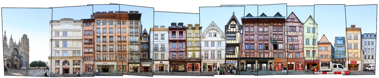
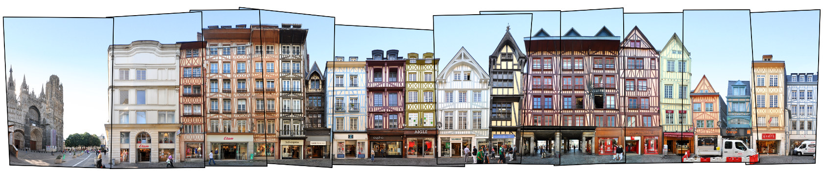
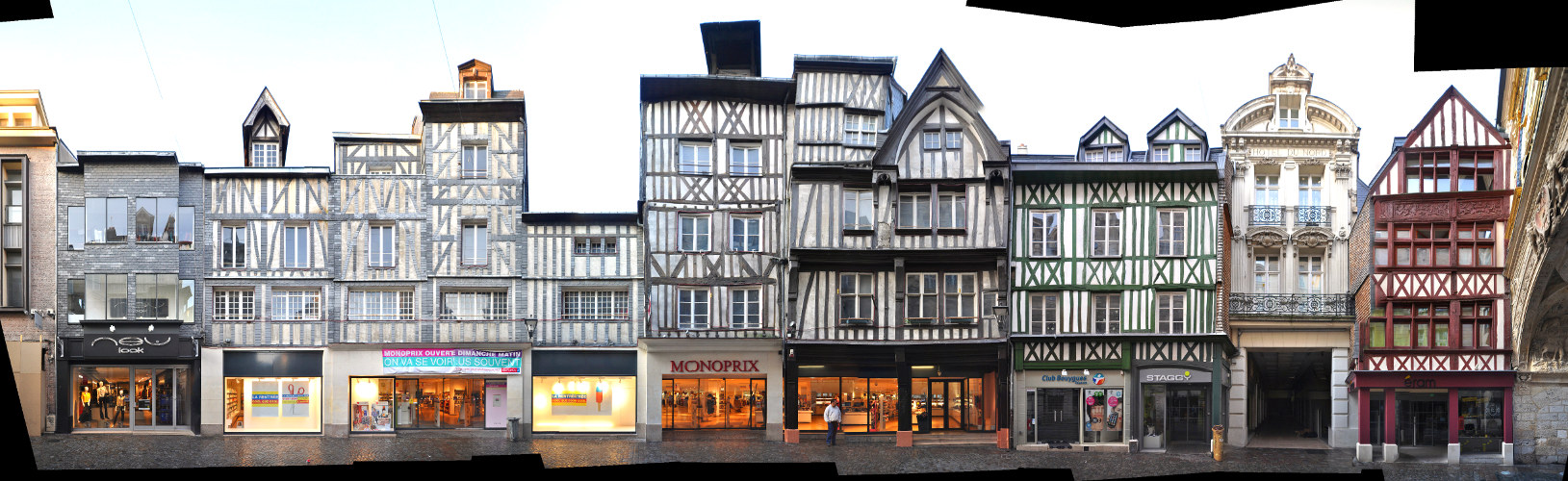
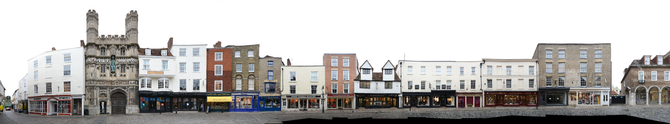
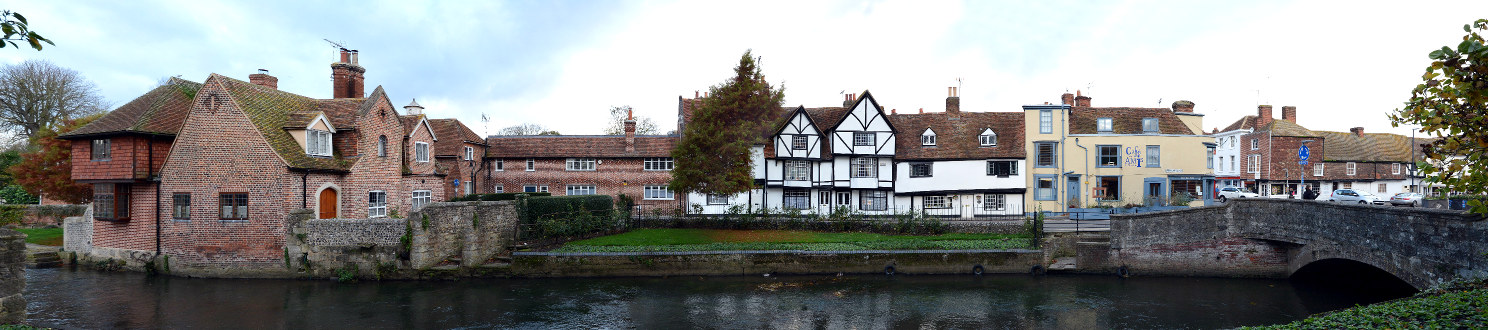
The panorama above shows one of the cities major non-religious landmarks, the Old Weavers House, at the right edge. It was used by the Huguenots and is one of the (still numerous) timber framed 16th and 17th century houses that survived the german Blitz bombings in world war II. St Peter’s street is named after St Peter’s church, which we see a little bit in the back on the left edge. The street connects the High Street at its east end with the Westgate in the west.

To find more published streetline views from the UK visit our United Kingdom archive.

Click for larger view:

Canterbury Cityscape UK Panorama Image

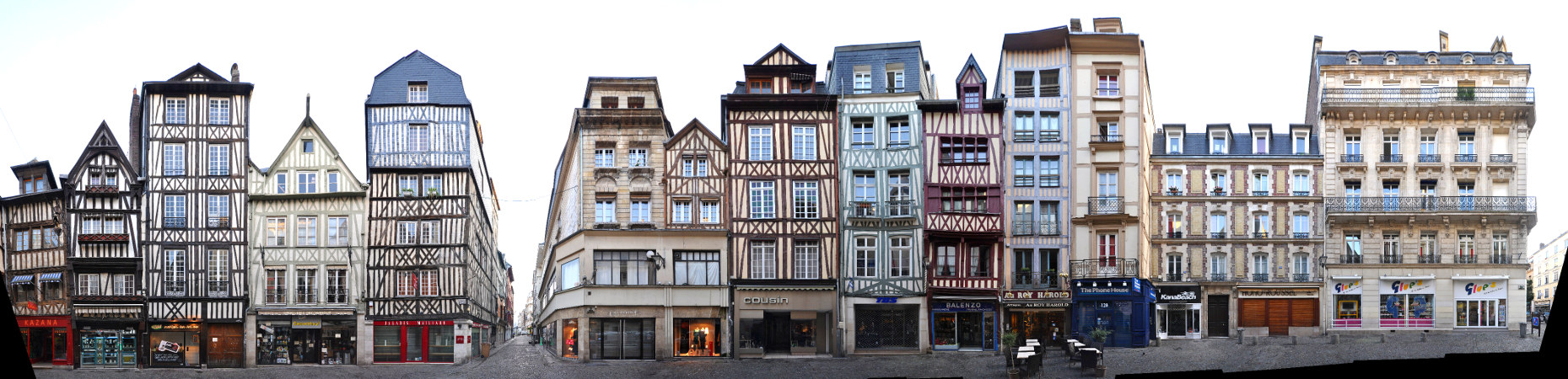
For classic view and more infos about the streetview:

Canterbury Panorama Foto

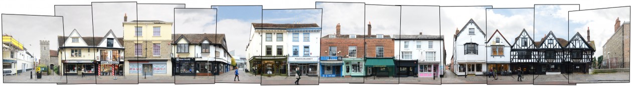
We have captured some more streetviews in Canterbury a few of which we present here in unfinnished previews:

Canterbury Panorama Buttermarket Cathedral Gate

Cathedral Gate | Buttermarket | Burgate

Canterbury Preview

Great Stour | Westgate Grove

Canterbury High Street

High Street | Royal Museum

Rouen | France | Rue du Gros-Horloge | Week 19

Rouen [latin: Rotomagus], was founded by the tribe of the Veliocasses as Ratumacos, lies about 100 km north-west of Paris and 200 km south of London on the shores of the river Seine. 2nd largest city in the Normandy and 33rd largest city in France.

Population: 111.000 [2013] | 103.000 [1990] | 123.000 [1931] | 116.000 [1901]

The roman Rotomagus was the second most important city of the roman province Gallia after Lugdunum (Lyon). It has been the seat of a bishop since the 4th century. Rouen was captured by the Normans in the 9th century and became the first capital of the Duchy of Normandy in the early 10th century. After the French conquered it again in 1204 it once again belonged to the brittish crown from 1419 to 1449. In late medieval times Rouen was one of the largest european cities with about 40.000 inhabitants. It was here that Joan of Arc was burned at the stake in 1431. Today the city is known for its gothic cathedral and for having the largest number of preserved timber framed buildings in France.

The Rue du Gros-Horloge is a grand example for half-timbered buildings in Rouen. Indeed it is the major street between the cathedral square, we see the Rouen Cathedral at the left edge, and the old marketsquare – the Place de Vieux Marché. The street is named after Rouen’s second landmark, the Gros-Horloge, situated a little further down the right side of the street. It is a fourteenth-century astronomical clock, prominently placed at the side of a tower crossing the street and facing the cathedral.

Find more material from the Normandy in our Normandy overview.

Click for larger view:

Rouen France street view framework version

For classic view and more infos about the street:

Rouen France Panorama half timbered framed

We documented several more streets in Rouen, including more stretches of the Rue du Gros-Horloge, for example (unfinnished):

Image Rouen street view block

And a section following the main panorama further down the right ending at the Gros-Horloge (unfinnished):

Rouen Gros-Horloge Normandie

Here is an unfinnished preview of a little side street, Rue Ecuyere:

Rouen Fachwerk Frankreich

Previously published from Rouen: Rue Ganterie

Rouen street view block image