Münster | Germany | Prinzipalmarkt | Week 34

Münster, founded in 793 when the missionary Liudger founded a monastery here, lies 200 km east of Amsterdam and 400 km west of Berlin. It is the 10th largest city in the state of Northrhine-Westfalia, but also the 20th largest city of Germany.

Population: 313.000 [2017] | 259.000 [1990] | 120.000 [1930] | 64.000 [1900]


Click for larger view:

Münster Leinwand Prinzipalmarkt Rathaus

For classic view:

Prinzipalmarkt Münster Architektur

Also in our archive, the opposite side of Prinzipalmarkt (german link):

Prinzipalmarkt Münster Giebelhäuser

Vienna | Austria | Graben | Week 32

Vienna [german: Wien; hungarian: Bécs; latin: Vindobona], first known settlement as Vedunia by the Celts, but earlier settlements existed. Vienna lies ca. in the middle between Prague (250 km to the nortwest) and Budapest (220 km to the southeast) only about 50 km west of the slovak capital Bratislava. It is the largest city of Austria and the 12th largest city in Europe.

Population: 1.840.000 [2016] | 1.540.000 [1991] | 1.936.000 [1934] | 1.769.000 [1900]

The historic centre of Vienna is one large UNESCO world heritage site. It developed mostly between the end of the osman siege of Vienna in 1683 and WWI and is shaped by the architectural ensembles in baroque, neo-classical and Art Nouveau style of the Habsburg Empire. Following its celtic roots Vienna was a roman castrum and city called Vindobona for four centuries. It first rose to prominence when the Babenberger family moved its residence to the then minor city in the 12th century. Its real height of power however came with the Habsburg family in the 15th century. They made it the capital of the Habsburg Empire and the Holy Roman Empire, withstood two osman sieges and created the Austro-Hungarian Empire after the congress of Vienna in 1815. The city became a world centre for music, arts and science in the 19th century (Mozart, Beethoven, Klimt, Freud etc.). Today Vienna is regarded a global city and home to several international organisations like the OPEC, the IAEO, the OSZE and of course, one of the home cities of the UNO. In Europe Vienna plays the role of a bridging city between Eastern and Western Europe.

Our cityscape above presents the Graben, an area once part of the wall of the roman castell, that later became a prestigious central shopping street with grand historicism and Art Nouveau architecture. Here we see, for example, the Anker-Haus by Otto Wagner on the left, the Grabenhof in the centre and the Husaren-Haus by Josef Hackhofer on the right edge.

Click for larger view:

Österreich Wien Graben Straßenansicht Architektur

For classic view and more infos about the place (german link):

Europe Habsburg Empire Austria Vienna Graben

Find a step-by-step sequence video of the composition of this streetline below:

Also finalized and published are these views of the Schwarzenberg-Square and the Wienzeile. Find more streetlines in our Vienna overview (german link).
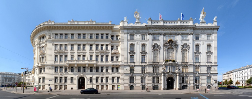
Wien Schwarzenbergplatz Architekturfotografie Bild Image Foto

Wien Vienna Wienzeilenhäuser

A preview of a ministry building in the Hintere Zollamtsstrasse.
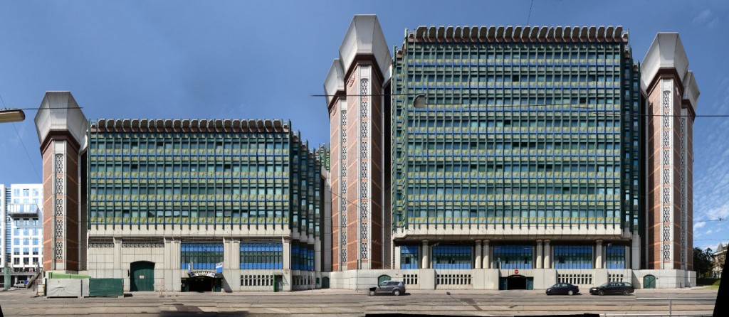
Wien Hintere Zollamtsstrasse Architektur modern

A preview of the Hofburg Theatre at the Ringstrasse of Vienna.

Panorama Wien Hofburgtheater


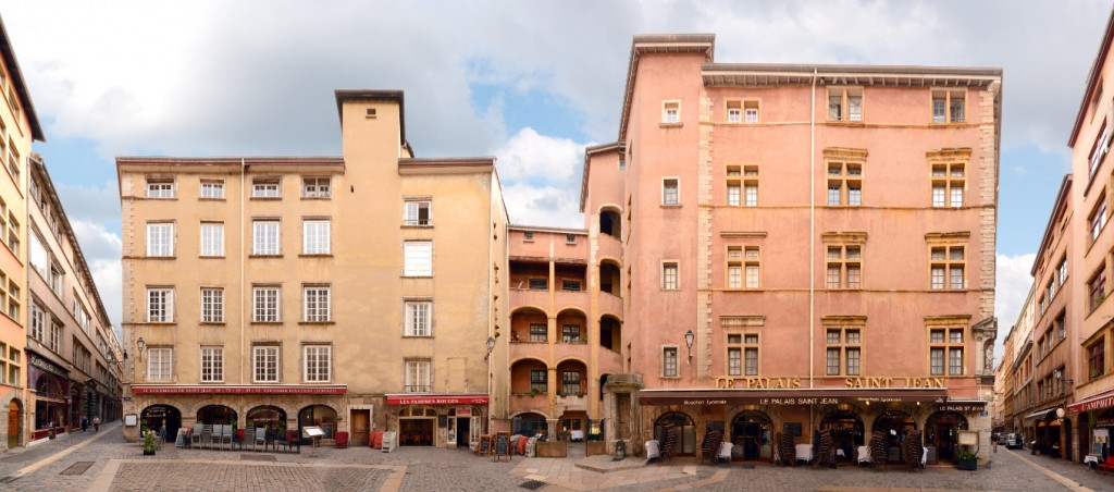
Lyon | France | Rue de la Republique | Week 31

Lyon [italian: Lione; old german: Leyden], founded by the Romans as Lugdunum in 43 BC, but earlier celtic settlements existed. The city lies about 300 km north of Marseille, 350 km west of Milan and about 400 km southeast of Paris. It is the 3rd largest city in France and no. 60 within the european union.

Population: 507.000 [2014] | 415.000 [1990] | 580.000 [1931] | 460.000 [1901]

Lyon is especially known for its history, its unique cityscape, its economical role in France and it is a UNESCO world heritage site. Following its roman foundation it was the Gaul capital for several centuries, before it became the centre of the Burgundian Kingdom. In 1032 it became part of the Holy Roman Empire and it wasn’t before the 14th century, that Lyon finally belonged to France. For centuries the city was the banking centre of France and  the archbishop of Lyon is regarded the highest religious authority in France. Another keystone of the cities importance had been the silk trade, which resulted in the cities numerous silk workshops and a fast growth during industrialisation. Also the Lumière brother invented the cinematographe in Lyon. Today the city is a centre of commerce, of education, the major transportation hub in southern France, the seat of Interpol and the „Capital of Lights“, thanks to its annual light festival Fête des Lumières.

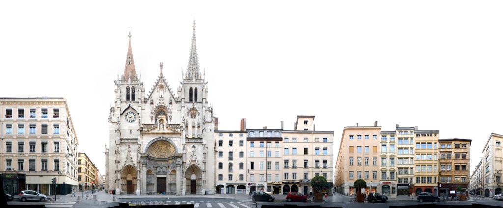
Here we see a part of the Rue de la Republique, the major shopping street in the centre of Lyon, running from the Place Bellecour (right edge) to the Hôtel de Ville (City Hall) further north. This section in the panorama ends at the Place de la Republique (left). The street was originally created in the 1850s with most buildings reflecting the Haussmann style of the era. Notable are the Art Deco style Cinema Pathé (with a golden rooster on top) and the former Le Progrés newspaper headquarters near the right end of the panorama.
Click for larger view:

Lyon street shopping Cinema Pathe Le Progres Architecture

For classic view and more infos about the place:

Rue de la Republique France

Find more streetline previews in our Lyon Architecture overview (german link).

Also finalized and published is this view of the Place Neuve Saint-Jean

Lyon Square Vieux Lyon

A preview of the church Saint Nizier with the adjoining Rue de Brest on its right

Saint Nizier Lyon

Quai Fulchiron across the Saône in the Vieux Lyon quarter, with the Fourviere hill in the background

Saône river panorama Lyon

Rouen | France | Rue du Gros-Horloge | Week 19

Rouen [latin: Rotomagus], was founded by the tribe of the Veliocasses as Ratumacos, lies about 100 km north-west of Paris and 200 km south of London on the shores of the river Seine. 2nd largest city in the Normandy and 33rd largest city in France.

Population: 111.000 [2013] | 103.000 [1990] | 123.000 [1931] | 116.000 [1901]

The roman Rotomagus was the second most important city of the roman province Gallia after Lugdunum (Lyon). It has been the seat of a bishop since the 4th century. Rouen was captured by the Normans in the 9th century and became the first capital of the Duchy of Normandy in the early 10th century. After the French conquered it again in 1204 it once again belonged to the brittish crown from 1419 to 1449. In late medieval times Rouen was one of the largest european cities with about 40.000 inhabitants. It was here that Joan of Arc was burned at the stake in 1431. Today the city is known for its gothic cathedral and for having the largest number of preserved timber framed buildings in France.

The Rue du Gros-Horloge is a grand example for half-timbered buildings in Rouen. Indeed it is the major street between the cathedral square, we see the Rouen Cathedral at the left edge, and the old marketsquare – the Place de Vieux Marché. The street is named after Rouen’s second landmark, the Gros-Horloge, situated a little further down the right side of the street. It is a fourteenth-century astronomical clock, prominently placed at the side of a tower crossing the street and facing the cathedral.

Find more material from the Normandy in our Normandy overview.

Click for larger view:

Rouen France street view framework version

For classic view and more infos about the street:

Rouen France Panorama half timbered framed

We documented several more streets in Rouen, including more stretches of the Rue du Gros-Horloge, for example (unfinnished):

Image Rouen street view block

And a section following the main panorama further down the right ending at the Gros-Horloge (unfinnished):

Rouen Gros-Horloge Normandie

Here is an unfinnished preview of a little side street, Rue Ecuyere:

Rouen Fachwerk Frankreich

Previously published from Rouen: Rue Ganterie

Rouen street view block image

Düsseldorf | Germany | Königsallee | Week 12

Düsseldorf [Dutch: Dusseldorp], founded in 12th century, got city rights in 1288, lies on the shores of the Rhine, 30 km north of Cologne and 170 km east of Brussels, 2nd largest city in the Bundesland Nordrhein Westphalen (Northrhine-Westphalia), 7th largest in Germany and 66th largest in europe.

Population: 605.000 (2014) | 576.000 (1990) | 478.000 (1930) | 214.000 (1900)

Düsseldorf is the capital of the german Bundesland Northrhine-Westphalia and a centre of the Rhine-Ruhr Metropolitan Area. A newly founded city of the 12th century it was named after the small river Düssel which flows into the Rhine here. It became the residence city of the Duchy of Berg in the 14th century. Today Düsseldorf is an important trade fair city and economic centre in germany. It is also well known for its carnival and its art academy (the Kunstakademie Düsseldorf).

Here we have one block along the west side of the Königsallee in Düsseldorf. Locally nicknamed the „Kö“, the street is one of the main luxury shopping streets of germany. This however is its so called „quiet side“, with mainly banks and hotels residing, instead of shops. The street is also known for its landscaped canal, lined with large old sycamore trees, running along the old site of the cities fortifications.

Visit our archive for other streetline panoramas from the Bundesland Northrhine-Westphalia.

Click for larger view:

Kö Königsallee Düsseldorf Ansicht View

For classic view and further details visit the archive (for english link click here):

Düsseldorf Kö Königsallee luxury shopping

In our archive other streets from Düsseldorf have been documented, including the Kurze Strasse, the Mittelstrasse or the market square amongst others. A finnished panorama of the media harbour has been published to our archive before (english link):

Medienhafen in Düsseldorf, Germany

Deauville | France | Rue du Casino | week 11

Deauville, first mentioned around 1060 as A Enilla, lies on the Normandy coast, west of Trouville, separated by the river Touques, also about 175 km west of Paris.

Population: 3.800 (2012) | 4.300 (1990) | 4.800 (1931)  | 2.900 (1901)

Deauville was just a small farming village up to the 1850s. Then Charles de Morny, half brother of Napoleon III., transformed it into an elegant seaside resort. With its race courses, marinas, villas, harbour, Grand Casino, international Festivals and the close proximity to Paris it became the „Queen of the Norman Beaches“. Deauville is home to several festivals and horse events throughout the year, the most prestigious being the Deauville American Film Festival. Marcel Proust worked on his novel „In search of lost time“ during his summers in Deauville.

With its development into the prime seaside resort in the Normandy, Deauville attracted the wealthy and famous french (including Coco Chanel, André Citroen, Yves Saint Laurent, Josephine Baker, Gustave Flaubert amongst others) and became the Parisian Riviera. Hence one could and can also find the high-class fashion labels in Deauville, with a concentration in the Rue du Casino (Casino Street), right opposite the Casino Barrière de Deauville. The flamboyant style of half timbered houses in Deauville is a product of the neo norman style of the late 19th century.

Visit our archive for other streetline panoramas from the Normandy.

Click for larger view:

Architecture Deauville France

For classic view and further details visit the archive:

neonormannischer Stil in Frankreich, Deauville

Cologne | Germany | Schildergasse | Week 8

Cologne [German: Köln, Latin: Colonia], founded over 2.000 years ago, lies in western Germany on the shores of the Rhine, ca. 160 km east of Brussels and 50 km south of the Ruhr region, largest city in the german state Northrhine-Westphalia, 4th largest in Germany and 29th in Europe.

Population: 1.047.00 (2014) | 953.000 (1990) | 740.000 (1930) | 372.000 (1900)

Cologne was declared a roman city as Colonia Claudia Ara Agrippensium (CCAA) in the year 50 and was capital of the province Germania inferior. Since then it always retained its prominent role in the region, has been a member of the Hanseatic League, has always been a key city of the Catholics and in more recent history also been famous for its Carnival. Cologne is part of the Rhine-Ruhr metropolitan region (the 6th largest in europe) and home to one UNESCO world heritage site – the Cologne Cathedral, the largest gothic church of Northern Europe.

The Schildergasse (literal english: shields alley) is, despite its modern looks, the second oldest street of Cologne, having been the major east-west street of the roman city. Today it is the cities major shopping street (and one of the most frequented in Germany) with several big department stores and high street labels. Cologne was one of the most severe hit german cities in WWII, so the old town looks rather modern today, as can be seen in this street section. The only historic building here is the Haus Schierenberg, built in 1894.

Visit our archive for other streetline panoramas from the Bundesland Northrhine-Westphalia.

Click for larger view:

Cologne Schildergasse Panorama

For classic view and further details visit the archive (for english link click here):

Schildergasse Shopping Panorama Foto Image

Helsingør | Denmark | Stengade | Week 7

Helsingør [old english: Elsinore] founded in the 1420s, lies in the north east of the danish main island Zealand on the narrowest point of the Øresund, 40 km north of Copenhagen, west of the swedish city Helsingborg across the Øresund, 13th largest city of Denmark

Population:  46.500 (2015) | 34.400 (2006)

Helsingør has for centuries been the harbour where passing ships had to pay the Sound Dues, for a long time the major income for the danish crown. Today there is an important and much frequented ferry line to Helsingborg in Sweden. However the city is even more famous for Kronborg castle, an UNESCO world heritage site and the place where Shakespeare’s play Hamlet was set. The old harbour has been turned into the Kulturhavn Kronborg (Culture Harbour Kronborg).

The Stengade is the major shopping street of Helsingør, running soutwest to northeast parallel to the sea in the south. Here on the east end of the street, there are some administrative buildings and fewer shops, which are concentrated towards the west end of the street.

Visit our archive for other streetline panoramas from Denmark.

Click for larger view:

Cityscape Helsingor Danmark

For classic view (unfinnished):

street panorama denmark Danmark

In our archive other sections of Stengade are included, as well as other streets from Helsingør and the Domkirke. Two unfinnished examples can be seen below.

Sct. Annagade

panorama Sct anna gade helsingor denmark

Domkirke

linear Domkirke in Helsingor