Zwickau | Germany | Hauptmarkt | Week 15

Zwickau, founded in the 12th century, lies 60 km south of Leipzig and about 150 km northwest of Prague at the foot of the ore mountains [german: Erzgebirge], 4th largest city in the german state Saxony and 88th largest city in Germany (2014).

Population: 91.000 (2014) | 122.000 (1988) | 85.000 (1930) | 56.000 (1900)

Zwickau quickly gained importance after its foundation and was a free imperial city in the early 14th century. Besides Wittenberg it was an early centre of the Lutheran Reformation. From the 15th to the 20th century Zwickau was a centre of the mining industry in Germany, especially for hard-coal from Zwickau and silver from the ore mountains. Hence the city played an important role in german industrialisation and was for centuries one of the main economic and cultural centres of Saxony. It is also a cradle of the german automobile industry with Audi and Horch being founded in the city, while during the GDR times it was the city of the Trabant, the most well known car of the eastern bloc.

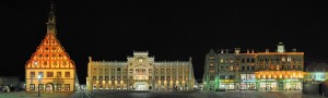
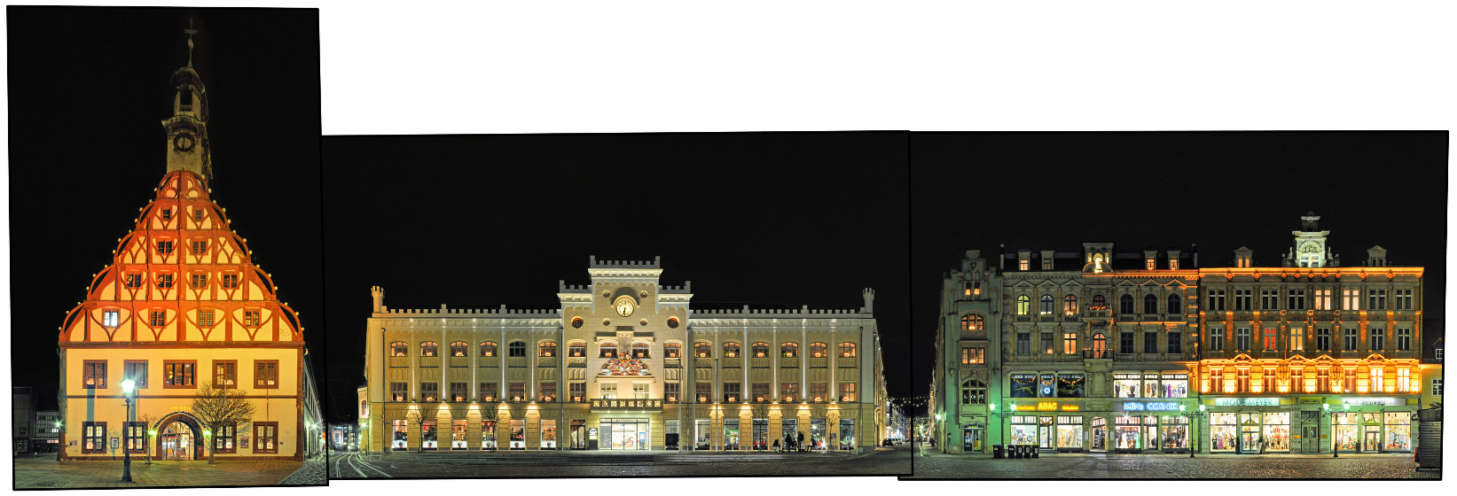
Here we see a night view in christmas lighting of the southern side of the main market square (Hauptmarkt), which includes two of the cities main buildings, the Gewandhaus on the left and the town hall in the centre. The Gewandhaus (cloth merchants‘ hall) was built in the 16th century and today serves as the main theatre of the city. The town hall was built in 1404 and features the elaborate city emblem above its portal. The last building on this side of the square on the far right, which was unfortunately hidden by christmas stalls for this photography, is the birthplace (and museum) for the famous composer Robert Schuhmann.

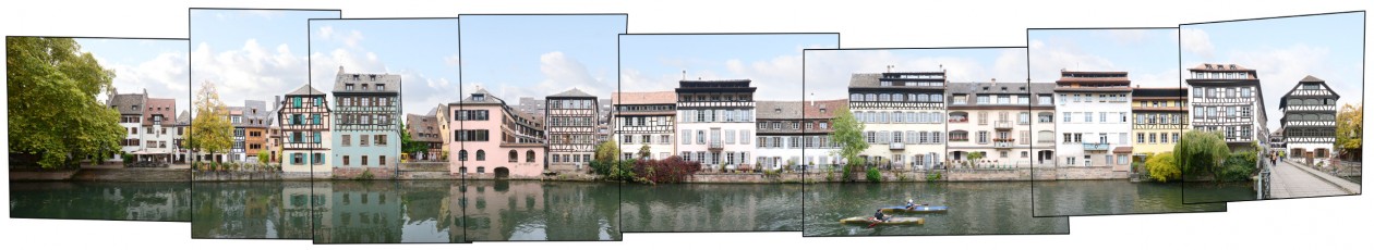
Visit our archive for other streetline panoramas from Saxony.

Click for larger view:

Zwickau Gewandhaus Rathaus Hauptmarkt

For classic view (english link):

Zwickau Gewandhaus

Strasbourg | France | La Petit France | Week 14

Strasbourg [german: Straßburg; dutch: Straatsburg], founded by the Romans as Argentoratum in 12 BCE, lies 100 km west of Stuttgart, 200 km south of Frankfurt and about 450 km east of Paris, largest city of the french region Alsace and 7th largest city in France.

Population: 274.000 (2012) | 252.000 (1990) | 181.000 (1931) | 151.00 (1900)

Strasbourg is the capital of the Alsace (german: Elsass) region, however today it is also one of the capitals of europe, being the seat of the several european institutions like the Council of Europe and the European Parliament as well as the International Institute of Human Rights. Strasbourg’s historic city centre, the Grande Île, has been declared an UNESCO world heritage site in 1988. Historically the city often changed sides between german or french rulers. Since the late 17th century mainly french, german was still the main language till the end of WWII. Strasbourg is an important economic centre and its port is the second largest on the Rhine after Dusiburg, Germany.

La Petit France is a historic quarter in the centre of Strasbourg, part of its UNESCO world heritage site. Here the river Ill forms a number of channels with half timbered houses lining up on the shores and the narrow streets, most of them dating from the 16th and 17th century. La Petit France is now one of Strasbourg’s main tourist attractions.

Visit our archive for other streetline panoramas from France.

Click for larger view:

Panorama Strasbourg La Petit France

For classic view (german link):

Strasbourg Petit France

In our archive other streets and squares from Strasbourg are documented. Two unfinnished examples can be seen below.

Grand Rue

Strasbourg Grand Rue Panorama

Rue des Grandes Arcades

Architecture Strasbourg Rue des Grandes Arcades