Görlitz | Germany | Augustastrasse | Week 30

Görlitz [polish: Zgorzelec], first mention as Goreliz in 1071. It is the easternmost city in germany, lying about 80 km east of Dresden, 120 km west of Wroclaw (Breslau) and 120 km north of Prague. Görlitz is the 6th largest city in the german state Saxony and the largest within the region Upper Lusatia (Oberlausitz).

Population: 55.000 [2015] | 72.000 [1990] | 94.000 (1930) | 81.000 [1900]

Görlitz is especially known for its well preserved old town, it is member of the working group historic cities in germany. From its early times the city belonged to the bohemian kingdom, later it became part of Saxony, then Silesia (in Prussia) and finally Germany (incl. GDR). It was a strong trade city in late medieval times, esp. due to its monopoly for woad trade in Bohemia. Görlitz was a member of the Lusatian League and as such held rights similar to free imperial cities for some time. In 1945 the new border between Germany and Poland cut through the city along the Neisse river. It’s eastern part is now an independent city – Zgorcelec in Poland. Economically the city has a long history in the production of trams and trains. Nowadays the city is also a favourite spot for big movie productions, earning it its nickname Görliwood.

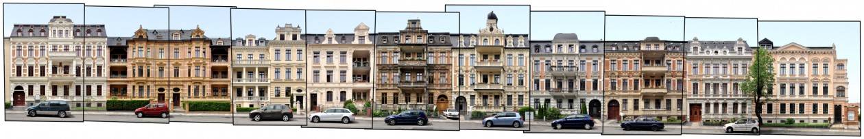
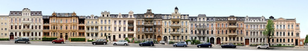
The street front above is a section of Augustastrasse, a street full of examples of historicism style, which is common in the areas around the old town centre. Görlitz is also known as a so called Pensionopolis, an attractive city with relatively low rents that attracts the elder and retired people. While the city experienced an economic decline since 1990 it still managed to restore the majority of its historic buildings – in large parts thanks to the anonymous Altstadtmillion (old town million). Between 1995 and 2016 each year the city received an anonymous amount of one million Deutsche Mark (later that amount in Euro) to be spent for reconstructing the old town. The results can be seen all over Görlitz.

Click for larger view:

Architektur Görlitz Sachsen Lausitz Schlesien

For classic view and more infos about the place (german here):

Görlitz Architecture Panorama

We documented more streets and places in Görlitz. Find some previews below. For more views from saxon cities follow the link to our Saxony archive.

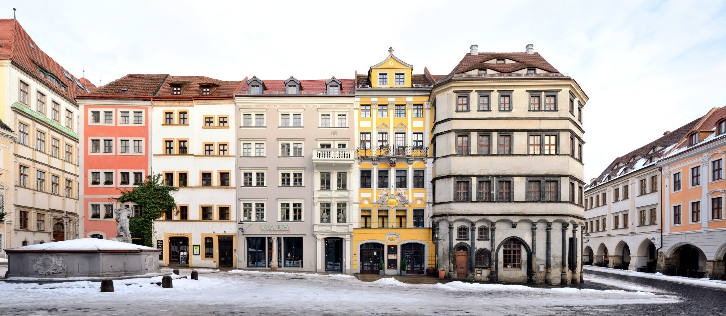
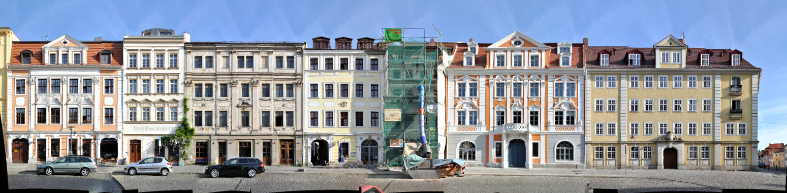
A panorama of the central block on the lower market square (Untermarkt).

Untermarkt Görlitz Panorama Foto

The Brüderstrasse between Obermarkt and Untermarkt with the Silesian Museum (left).

streetview Görlitz Brüderstrasse old town streetline

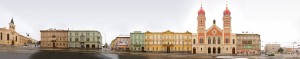
A section of the Obermarkt (Upper Market) from 2011.
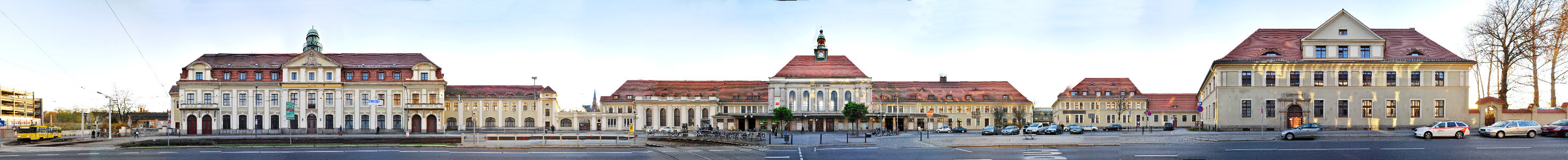
Oberlausitz Görlitz Architektur Fassaden

The main station.

Görlitz Bahnhof train station

Kalovy Vary | Czech Republic | Stará Louka | Week 18

Karlovy Vary [english: Carlsbad; german: Karlsbad], assumed to be founded by Charles IV, Holy Roman Emperor and Czech King around 1350, lies about 120 km west of Prague and 150 km south of Leipzig at the confluence of the rivers Ohre and Teplá. 20th largest city in the Czech Republic.

Population: 50.000 [2014] | 56.000 [1991] | 55.000 [1930]

Emperor Charles IV, who appraised the healing power of the hot springs in the area, gave city privileges to the town, which was subsequently named after him. From 1526 Bohemia including Karlovy Vary belonged to the Habsburg Monarchy. In the 18th and 19th century Karlsbad gained more and more importance as the foremost spa town in central europe. Its visitors included Tsar Peter the Great, Goethe, Karl Marx, Morzart, Richard Wagner, Atatürk, Bach, Beethoven and Sigmund Freud amongst others. After World War II the german majority population was expelled from Karlsbad and the Czech Republic. Since 1989 the city is regaining its former spa town status, attracting international tourists, especially a large number of russian visitors.

The Stara Louka (german: Alte Wiese which means old meadow) lies at the centre of the Spa Area of the city along the Teplá river. It is regarded its most picturesque street and main esplanade. Here the valley is very narrow and the hills start right behind these buildings with a popular viewpoint pavillon seen above. A little further to the left the Art Nouveau Grandhotel Pupp is situated on this street, the major setting of the James Bond movie „Casino Royale“.

Find more material from Karlovy Vary in our Czech Republic overview.

Click for larger view:

Foto Karlsbad Alte Wiese Tschechien

For classic view and more infos about the street (german link):

Karlovy Vary Stara Louka

An alternative view of the Stara Louka as a classic panorama:

Karlovy Vary Stara Louka

Another street view (work in progress) from Carlsbad:

Kalrsbad Panorama Preview

Plzeň | Czech Republic | Great Synagogue | Week 1

Plzeň [german: Pilsen], founded ca. 1295 as New Plzen while the nearby Starý Plzenec (Old Plzen) was first mentioned in 976, situated 90 km west of Prague, 4th largest city of the Czech Republic

Population: 169.000 (2015) | 173.000 (1991) | 115.000 (1930) | 68.000 (1900)

Plzen is known worldwide for the Pilsner Beer created here in the 19th century. Plzen is also home to the Skoda Works, one of the worlds largest industrial companies of the 20th century, not to be confused with the Skoda Automobile brand.

In 2015 Plzen is a European Capital of Culture (along with Mons, Belgium).

Our cityscape panorama shows the Great Synagogue (czech: Velká Synagoga) of Plzen on the street Sady Pětatřicátníků. It is europe’s second largest synagogue, designed by Emmanuel Klotz and finnished in 1893. This view was taken on the 31st of December 2014 when the city was empty while everyone was preparing for New Years Eve. We also photographed the market square of the city with all its four sides, the namesti Republiky, amongst other street scenes.

Visit the PanoramaStreetline archive for more Streetline Panoramas from the Czech Republic.

Click for larger view:

Pilsen Große Synagoge

For classic view and more details visit the archive:

Pilsen Stadtbild Straßenzug Tschechien