Vienna | Austria | Graben | Week 32

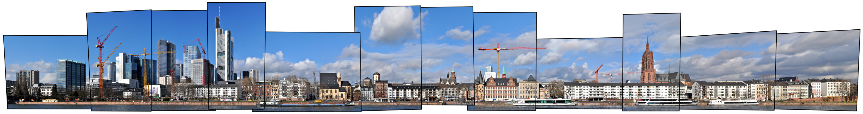
Vienna [german: Wien; hungarian: Bécs; latin: Vindobona], first known settlement as Vedunia by the Celts, but earlier settlements existed. Vienna lies ca. in the middle between Prague (250 km to the nortwest) and Budapest (220 km to the southeast) only about 50 km west of the slovak capital Bratislava. It is the largest city of Austria and the 12th largest city in Europe.

Population: 1.840.000 [2016] | 1.540.000 [1991] | 1.936.000 [1934] | 1.769.000 [1900]

The historic centre of Vienna is one large UNESCO world heritage site. It developed mostly between the end of the osman siege of Vienna in 1683 and WWI and is shaped by the architectural ensembles in baroque, neo-classical and Art Nouveau style of the Habsburg Empire. Following its celtic roots Vienna was a roman castrum and city called Vindobona for four centuries. It first rose to prominence when the Babenberger family moved its residence to the then minor city in the 12th century. Its real height of power however came with the Habsburg family in the 15th century. They made it the capital of the Habsburg Empire and the Holy Roman Empire, withstood two osman sieges and created the Austro-Hungarian Empire after the congress of Vienna in 1815. The city became a world centre for music, arts and science in the 19th century (Mozart, Beethoven, Klimt, Freud etc.). Today Vienna is regarded a global city and home to several international organisations like the OPEC, the IAEO, the OSZE and of course, one of the home cities of the UNO. In Europe Vienna plays the role of a bridging city between Eastern and Western Europe.

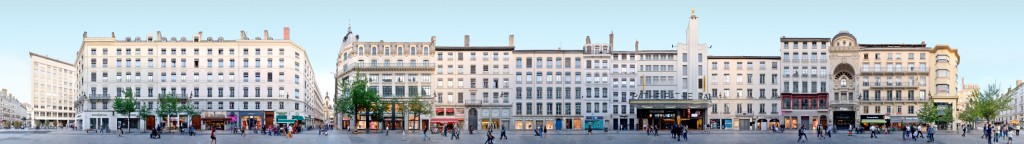
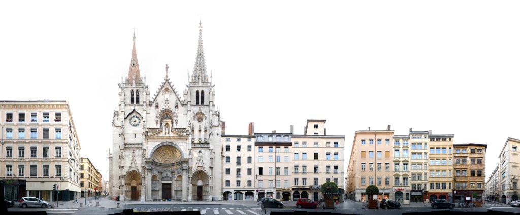
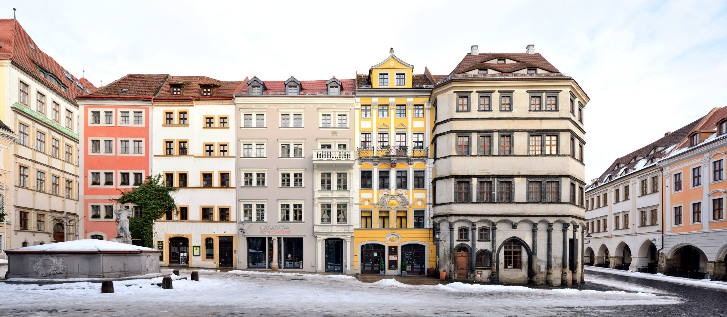
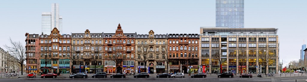
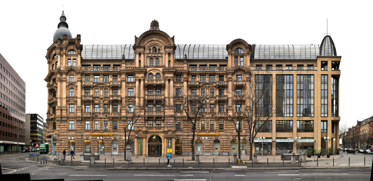
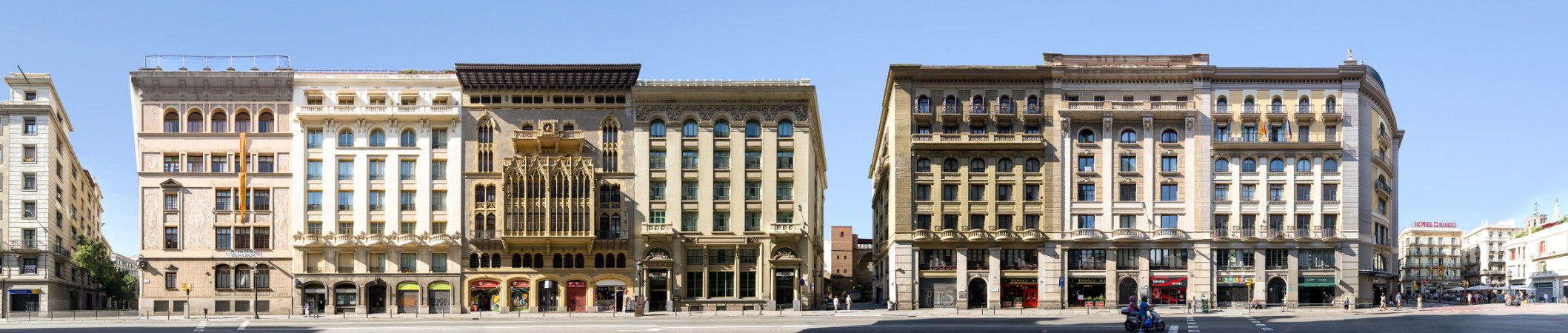
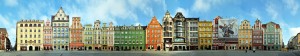
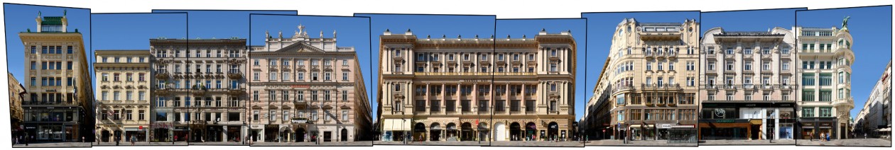
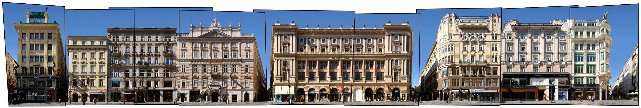
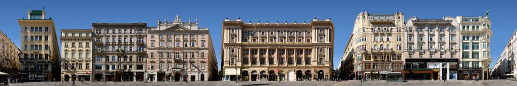
Our cityscape above presents the Graben, an area once part of the wall of the roman castell, that later became a prestigious central shopping street with grand historicism and Art Nouveau architecture. Here we see, for example, the Anker-Haus by Otto Wagner on the left, the Grabenhof in the centre and the Husaren-Haus by Josef Hackhofer on the right edge.

Click for larger view:

Österreich Wien Graben Straßenansicht Architektur

For classic view and more infos about the place (german link):

Europe Habsburg Empire Austria Vienna Graben

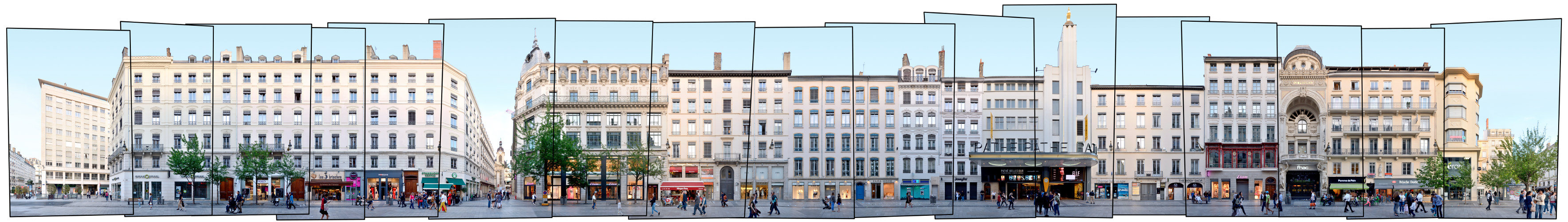
Find a step-by-step sequence video of the composition of this streetline below:

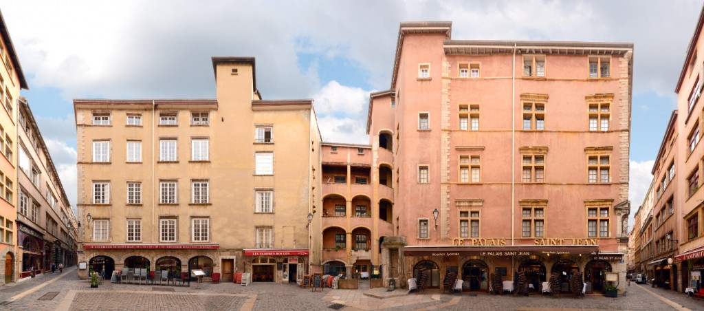
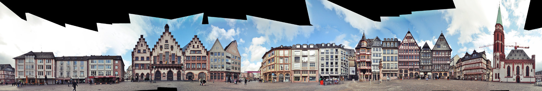
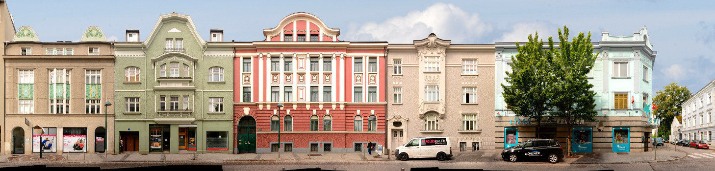
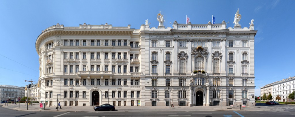
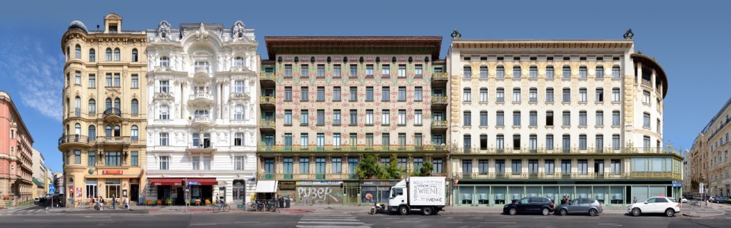
Also finalized and published are these views of the Schwarzenberg-Square and the Wienzeile. Find more streetlines in our Vienna overview (german link).

Wien Schwarzenbergplatz Architekturfotografie Bild Image Foto

Wien Vienna Wienzeilenhäuser

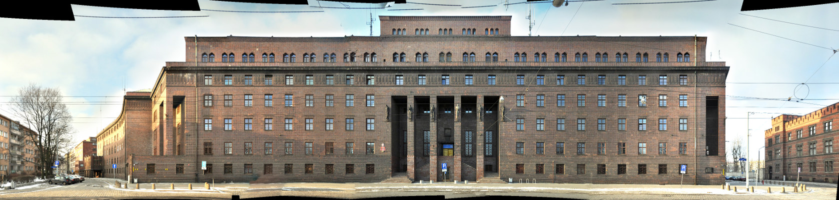
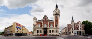
A preview of a ministry building in the Hintere Zollamtsstrasse.

Wien Hintere Zollamtsstrasse Architektur modern

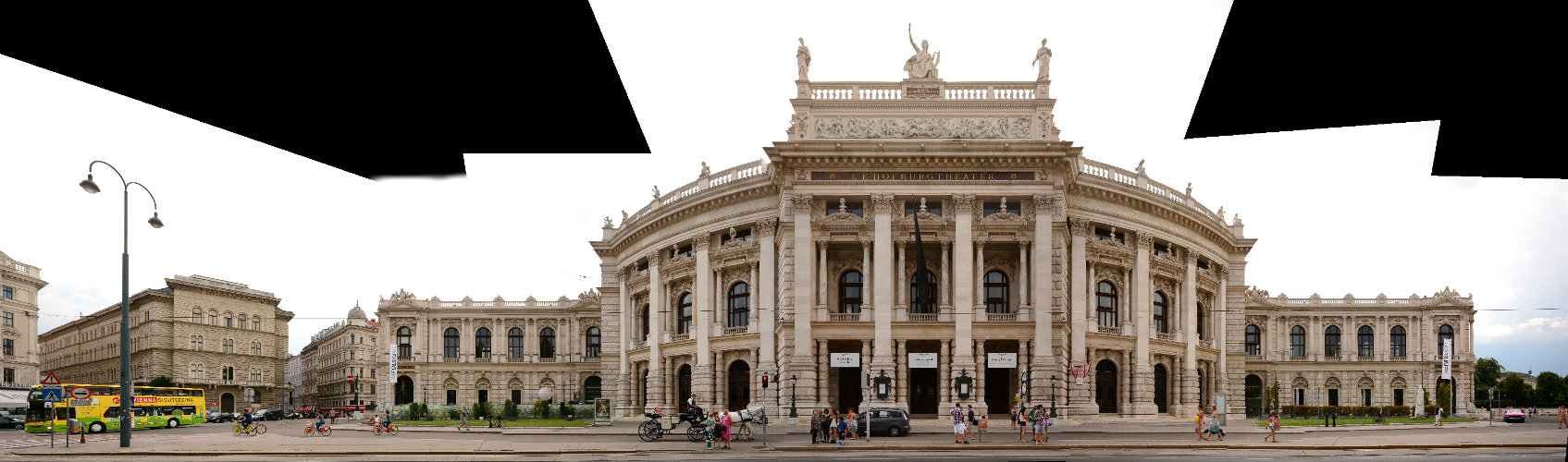
A preview of the Hofburg Theatre at the Ringstrasse of Vienna.

Panorama Wien Hofburgtheater


Lyon | France | Rue de la Republique | Week 31

Lyon [italian: Lione; old german: Leyden], founded by the Romans as Lugdunum in 43 BC, but earlier celtic settlements existed. The city lies about 300 km north of Marseille, 350 km west of Milan and about 400 km southeast of Paris. It is the 3rd largest city in France and no. 60 within the european union.

Population: 507.000 [2014] | 415.000 [1990] | 580.000 [1931] | 460.000 [1901]

Lyon is especially known for its history, its unique cityscape, its economical role in France and it is a UNESCO world heritage site. Following its roman foundation it was the Gaul capital for several centuries, before it became the centre of the Burgundian Kingdom. In 1032 it became part of the Holy Roman Empire and it wasn’t before the 14th century, that Lyon finally belonged to France. For centuries the city was the banking centre of France and  the archbishop of Lyon is regarded the highest religious authority in France. Another keystone of the cities importance had been the silk trade, which resulted in the cities numerous silk workshops and a fast growth during industrialisation. Also the Lumière brother invented the cinematographe in Lyon. Today the city is a centre of commerce, of education, the major transportation hub in southern France, the seat of Interpol and the „Capital of Lights“, thanks to its annual light festival Fête des Lumières.

Here we see a part of the Rue de la Republique, the major shopping street in the centre of Lyon, running from the Place Bellecour (right edge) to the Hôtel de Ville (City Hall) further north. This section in the panorama ends at the Place de la Republique (left). The street was originally created in the 1850s with most buildings reflecting the Haussmann style of the era. Notable are the Art Deco style Cinema Pathé (with a golden rooster on top) and the former Le Progrés newspaper headquarters near the right end of the panorama.

Click for larger view:

Lyon street shopping Cinema Pathe Le Progres Architecture

For classic view and more infos about the place:

Rue de la Republique France

Find more streetline previews in our Lyon Architecture overview (german link).

Also finalized and published is this view of the Place Neuve Saint-Jean

Lyon Square Vieux Lyon

A preview of the church Saint Nizier with the adjoining Rue de Brest on its right

Saint Nizier Lyon

Quai Fulchiron across the Saône in the Vieux Lyon quarter, with the Fourviere hill in the background

Saône river panorama Lyon

Görlitz | Germany | Augustastrasse | Week 30

Görlitz [polish: Zgorzelec], first mention as Goreliz in 1071. It is the easternmost city in germany, lying about 80 km east of Dresden, 120 km west of Wroclaw (Breslau) and 120 km north of Prague. Görlitz is the 6th largest city in the german state Saxony and the largest within the region Upper Lusatia (Oberlausitz).

Population: 55.000 [2015] | 72.000 [1990] | 94.000 (1930) | 81.000 [1900]

Görlitz is especially known for its well preserved old town, it is member of the working group historic cities in germany. From its early times the city belonged to the bohemian kingdom, later it became part of Saxony, then Silesia (in Prussia) and finally Germany (incl. GDR). It was a strong trade city in late medieval times, esp. due to its monopoly for woad trade in Bohemia. Görlitz was a member of the Lusatian League and as such held rights similar to free imperial cities for some time. In 1945 the new border between Germany and Poland cut through the city along the Neisse river. It’s eastern part is now an independent city – Zgorcelec in Poland. Economically the city has a long history in the production of trams and trains. Nowadays the city is also a favourite spot for big movie productions, earning it its nickname Görliwood.

The street front above is a section of Augustastrasse, a street full of examples of historicism style, which is common in the areas around the old town centre. Görlitz is also known as a so called Pensionopolis, an attractive city with relatively low rents that attracts the elder and retired people. While the city experienced an economic decline since 1990 it still managed to restore the majority of its historic buildings – in large parts thanks to the anonymous Altstadtmillion (old town million). Between 1995 and 2016 each year the city received an anonymous amount of one million Deutsche Mark (later that amount in Euro) to be spent for reconstructing the old town. The results can be seen all over Görlitz.

Click for larger view:

Architektur Görlitz Sachsen Lausitz Schlesien

For classic view and more infos about the place (german here):

Görlitz Architecture Panorama

We documented more streets and places in Görlitz. Find some previews below. For more views from saxon cities follow the link to our Saxony archive.

A panorama of the central block on the lower market square (Untermarkt).

Untermarkt Görlitz Panorama Foto

The Brüderstrasse between Obermarkt and Untermarkt with the Silesian Museum (left).

streetview Görlitz Brüderstrasse old town streetline

A section of the Obermarkt (Upper Market) from 2011.

Oberlausitz Görlitz Architektur Fassaden

The main station.

Görlitz Bahnhof train station

Frankfurt | Germany | Mainufer | Week 28

Frankfurt am Main [italian: Francoforte sul Meno], first mention as Franconofurd in 794, but probably inhabited since the Romans. Frankfurt is situated ca. in the middle of the line Brussels – Prague and about 400 km south of Hamburg. It is the largest city (but not the capital) of the german state Hesse, the 5th largest in Germany and the 48th largest in Europe.

Population: 733.000 [2015] | 645.000 [1990] | 541.000 [1930] | 289.000 [1900]

Frankfurt had been one of the most important cities in the Holy Roman Empire ever since the division of Charlemagne’s Frankish Empire in 843. From 1147 to 1792 most german kings and emperors were crowned in Frankfurt. The city became a free imperial city in 1220 and kept this status till Napoleon. After a brief period of dependance it was a free city again until it was annexed by Prussia in 1866. Frankfurt gained a status as an important trade fair city as early as the 13th century and it established an early currency exchange system in the late 16th century. Today it is the leading financial centre of continental europe, a leading trade fair city and a significant cultural and commercial centre, including central europe’s busiest airport.

This linear panorama view depicts the northern shore of the river Main from the Bankenviertel (banking district) on the left along the central old town of Frankfurt up to the Alte Brücke (old bridge) on the right. Prominent features are the banks skyscrapers on the left, which form the basis for all classic skyline images of Frankfurt, in the centre of the panorama we see the towers around the central square Römerberg and further to the right we see the large Frankfurt Cathedral (german: Kaiserdom St. Bartholomäus). One main feature is missing from this view however, in the middle the river is crossed by the Eiserne Steg bridge, a pedestrian connection to the south bank. See our archive version for more infos, backgrounds and an explanation of the bridge’s dissapearing.

Click for larger view:

Frankfurt Mainkai mit Bankenviertel und Skyline im Panorama

For classic view and more infos about the place (german link):

Frankfurt Mainkai Panorama

We documented more streets and places, which can be seen in our Frankfurt overview.

Some of these examples:

Kaiserstrasse

Kaiserstrasse streetview Frankfurt panorama image foto

Römerberg | City Hall | Nikolaikirche (unfinnished)

Römer Frankfurt Markt Römerberg

Gallusanlage (unfinnished)

Gallusanlage Frankfurt Main Commerzbank

Barcelona | Spain | Passeig de Gracia | Week 24

Barcelona [latin: Barcino; greek: Varkelóni] founded by the Laietani as Barkeno sometime before 250 BC, later restructured by the Carthaginians and Romans. Lies on the mediterranean coast in north-east spain, about 500 km east of Madrid, 900 km south of Paris and 300 km south-west of Marseille. Second largest city in Spain and 17th largest city in europe.

Population: 1.605.000 (2015) | 1.707.000 (1990) | 1.006.000 (1930) | 544.000 (1900)

Barcelona is the capital of the autonomous spanish region Catalonia and its economic centre. It has always played an important rule as a major harbour on the mediterranean coast and is the seat of the Union for the Mediterranean, an organization of european, african and arabian countries. In 1992 it hosted the Olympic Games and it is listed as a UNESCO world heritage site with works by the modernisme architects Antoni Gaudí and Lluís Domènech i Montaner. Gaudís magnum opus, the Basilica Sagrada Familia which was started in 1882 and is scheduled to be finnished in 2026, is a major tourist attraction of europe.

The Passeig de Gràcia is regarded the most elegant street of Barcelona and runs through the Eixample from the Placa de Catalunya in the south to the Gràcia district in the north. Here the leading modernisme architects created several representative buildings in the later 19th and early 20th century. Amongst the architects that worked on this street block we find Lluís Domènech i Montaner with the Casa Lleó-Morera at the left edge, Antoni Gaudí with the famous Casa Batlló, the second last on the right and Josep Puig i Cadafalch with the Casa Amatller on its left side. With all these architects and their distinct styles so close to each other this street block was later famously called the Mansana de la Discordia – meaning at the same time Apple or Block of discord and referencing greek mythology in view of this built competition of Modernisme. Find more infos and detail views in our archive or look for other Barcelona streetlines.

Click for larger view:

Panorama Casa Batllo Passeig de Gracia Amatllo

For classic view and further details visit the archive (german link):

Casa Batllo Antoni Gaudi Barcelona Espana

Another published streetline view of Barcelona is the Placa Reial:

Placa Reial Barcelona

We documented more than 50 streets and places in Barcelona. Find some unfinnished examples below.

Barcelona Via Laietana Architecture Photography

Via Laietana, part of this longer panorama:

Barcelona Via Laietana streetline

Via Laietana

Architecture Barcelona Ronda de la Universitat

Ronda de la Universitat

Streetline Architekturfotografie Spanien Katalonien

Plaza del Sol

Parroquia de Christo Rey Church Barcelona

Parroquia De Cristo Rey

Wroclaw | Poland | Rynek | Week 16

Wroclaw [german: Breslau], first mentioned as Wortizlawa around 900, lies ca. in the middle of the triangle Berlin – Warsaw – Vienna about 250-300 km away from each capital, 4th largest city in Poland, 61st largest city in europe.

Population: 633.000 [2014] | 641.000 [1990] | 625.000 [1933] | 422.000 [1900]

Wroclaw is a european capital of culture in 2016.

Wroclaw has been the capital of the historical region Silesia [german: Schlesien] and is the capital of the Lower Silesian Voivodeship in Poland today. It is the seat of a roman-catholic arch bishop and an evangelic Diocese. In the 15th century it was a member of the Hanseatic League. Together with Silesia Wroclaw has had a very changeful history, belonging successively to Poland, Bohemia, Hungary, Austria, Prussia and Germany until 1945. Then the population was completely replaced and the Germans had to leave the city, while Poles that had to leave areas around Lviv in the east had to move in.

The Rynek [engl: Ring] has historically been called the „Breslauer Ring“ and is the main market square of the city. It is an unusual square in the sense that it has a large middle block of buildings (incl. the town hall) with small alleys going through. Hence there are eight sides of the square, the four larger outsides and four inner sides. Here we see the south side, historically called the „Goldene-Becher-Seite“ [engl: the golden cup side] or „Seite beym alten Galgen“ [engl: side at the old gibbet]. Even if it looks historic, almost all buildings on this side had been destroyed in WWII and later been reconstructed resembling the facades of the early 19th century.

Earlier we have published two more outer sides of the Rynek, the westside and the northside:

Wroclaw Rynek Photography Panorama Image Pic

Wroclaw Breslau Großer Ring Nordseite Rynek

Click for larger view:

Photography Wroclaw Rynek Foto Image Picture Panorama

For classic view and more infos about the square (german link):

Breslau Großer Ring Südseite

We did document several more streets and views from Wroclaw, yet unfinnished, so we can add a few previews here:

Der Tritt oder Mittelblock des Breslauer Ring

one side of the middle block on Rynek

Bezirksgericht in Wroclaw, Podwale

the former prison (built 1844-1887) at the Stadtgraben (now Podwale) which is now a district court

Policji Wroclaw Podwale

the Police Headquarter (built 1927) in Podwale as well

Architektur Breslau Polen

buildings along the street circle around the old town at Kazimierza Wielkiego


Wels | Austria | Stadtplatz | Week 6

Wels, city foundation as the roman Ovilava in the 2nd century, situated centrally in Upper Austria on the shores of the river Traun, ca. 200 km west of Vienna and 100 km east of Salzburg, 2nd largest city of the Bundesland Oberösterreich (Upper Austria) and 8th largest city in Austria.

Population: 60.000 (2015) | 52.600 (1991) | 26.000 (1934) | 17.000 (1900)

Wels is a Statuarstadt and seat of the county of Wels-Land in Upper Austria. As Ovilava it was an important city in roman times and became capital of the roman province of Noricum Ripensis. An important regional trade centre in the Middle Ages it was often visited by Emperor Maximilian I, who died at Wels Castle in 1519.

This is the north side of the Stadtplatz, the central square in Wels, from the Ledererturm in the west to the Stadtpfarrkirche in the East. The Stadtplatz originates from the 13th century and some buildings still date back to that time. The Ledererturm is the last remaining tower of the medieval walls of Wels and its design dates from the early 17th century. Its name refers to the medieval Lederer business (english: Tanning).

Visit our archive for more streetline panoramas from Austria.

Click for larger view:

Austria Wels Stadtplatz City Square Ledererturm

For classic view and further details visit the archive (for english link click here):

Wels Stadtplatz Ledererturm Oberösterreich

We also photographed the south side of the Stadtplatz with the town hall, the Salome Alt House and the Kremsmünstererhof to be finnished later. Two more previews of the Medien Kultur Haus (former Sparkasse) and the Bahnhofstrasse can be seen below:

Altes Sparkassengebäude Wels

Wels Bahnhofstrasse Österreich