Vienna | Austria | Graben | Week 32

Vienna [german: Wien; hungarian: Bécs; latin: Vindobona], first known settlement as Vedunia by the Celts, but earlier settlements existed. Vienna lies ca. in the middle between Prague (250 km to the nortwest) and Budapest (220 km to the southeast) only about 50 km west of the slovak capital Bratislava. It is the largest city of Austria and the 12th largest city in Europe.

Population: 1.840.000 [2016] | 1.540.000 [1991] | 1.936.000 [1934] | 1.769.000 [1900]

The historic centre of Vienna is one large UNESCO world heritage site. It developed mostly between the end of the osman siege of Vienna in 1683 and WWI and is shaped by the architectural ensembles in baroque, neo-classical and Art Nouveau style of the Habsburg Empire. Following its celtic roots Vienna was a roman castrum and city called Vindobona for four centuries. It first rose to prominence when the Babenberger family moved its residence to the then minor city in the 12th century. Its real height of power however came with the Habsburg family in the 15th century. They made it the capital of the Habsburg Empire and the Holy Roman Empire, withstood two osman sieges and created the Austro-Hungarian Empire after the congress of Vienna in 1815. The city became a world centre for music, arts and science in the 19th century (Mozart, Beethoven, Klimt, Freud etc.). Today Vienna is regarded a global city and home to several international organisations like the OPEC, the IAEO, the OSZE and of course, one of the home cities of the UNO. In Europe Vienna plays the role of a bridging city between Eastern and Western Europe.

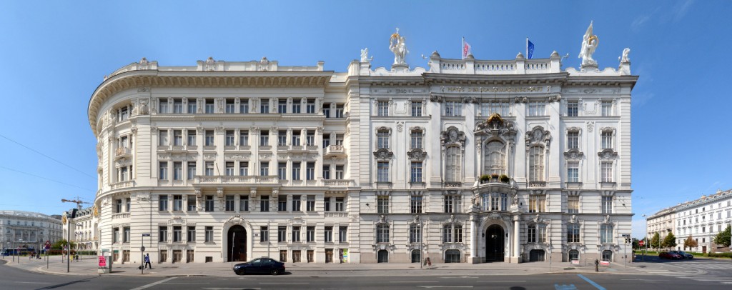
Our cityscape above presents the Graben, an area once part of the wall of the roman castell, that later became a prestigious central shopping street with grand historicism and Art Nouveau architecture. Here we see, for example, the Anker-Haus by Otto Wagner on the left, the Grabenhof in the centre and the Husaren-Haus by Josef Hackhofer on the right edge.

Click for larger view:

Österreich Wien Graben Straßenansicht Architektur

For classic view and more infos about the place (german link):

Europe Habsburg Empire Austria Vienna Graben

Find a step-by-step sequence video of the composition of this streetline below:

Also finalized and published are these views of the Schwarzenberg-Square and the Wienzeile. Find more streetlines in our Vienna overview (german link).

Wien Schwarzenbergplatz Architekturfotografie Bild Image Foto

Wien Vienna Wienzeilenhäuser

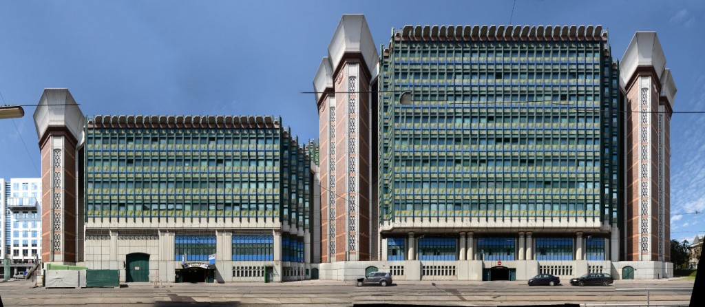
A preview of a ministry building in the Hintere Zollamtsstrasse.

Wien Hintere Zollamtsstrasse Architektur modern

A preview of the Hofburg Theatre at the Ringstrasse of Vienna.

Panorama Wien Hofburgtheater


Edinburgh | United Kingdom | Victoria Street | Week 20

Edinburgh [scottish gaelic: Dùn Èideann; french: Édimbourg], the hill forth Din Eidyn by the Gododdin tribe was built sometime before 600 AD and the city was founded as a royal burgh in the early 12th century. Situated about 70 km east of Glasgow and ca. 550 km north of London on the southern shore of the Firth of Forth. 2nd largest city in Scotland, 8th largest city in the United Kingdom and 61st largest city in the european union.

Population: 493.000 [2014] | 419.000 [1991] | 439.000 [1991] | 395.000 [1901]

Edinburgh, lying east of Glasgow in the scottish central belt, has been the capital of Scotland since the mid 15th century, hence it is the seat of the Scottish Parliament and of the monarchy in Scotland. The city is a UNESCO world heritage site since 1995, notably for its Old Town with Edinburgh Castle, the Holyrood Palace and the Royal Mile connecting the two, as well as the planned 18th century Georgian New Town. The city is also home to the National Museum and the National Library of Scotland as well as the Scottish National Gallery. Today the city is known for its strong economic, especially in the financial sector and the tourism industry, as well as its cultural festivals, especially the Edinburgh International Festival and the Fringe Festival.

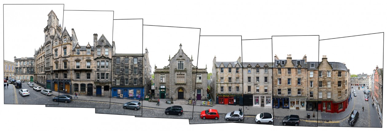
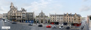
Victoria Street is the historical, being called West Bow then, entrance to the Castle Hill from western direction. It was transformed to its current shape in the early 19th century and renamed Victoria Street when Queen Victoria was crowned. Most buildings were errected in the mid 19th century, though some older buildings remained at the foot of the street. Here we see the grand India Buildings from 1864 on the left and the former St. John’s Church from 1838 in the middle.

For more Edinburgh street views visit our Edinburgh Architecture blog post.

Click for larger view:

Edinburgh Panorama street view photography

For classic view and more infos about the street:

Edinburgh Streetview Photography Scotland

We documented several more streetline views in the Old Town and New Town of Edinburgh (see Edinburgh blog post) including the complete Royal Mile. This section of the Royal Mile (Lawnmarket) has been published before:

Scotland Royal Mile Photography

And a preview of the Royal Mile along the High Street:

Edinburgh Royal Mile Panorama

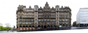
Another unfinnished preview of the Jenners department store in the New Town:

Edinburgh Jenners Preview