Kalovy Vary | Czech Republic | Stará Louka | Week 18

Karlovy Vary [english: Carlsbad; german: Karlsbad], assumed to be founded by Charles IV, Holy Roman Emperor and Czech King around 1350, lies about 120 km west of Prague and 150 km south of Leipzig at the confluence of the rivers Ohre and Teplá. 20th largest city in the Czech Republic.

Population: 50.000 [2014] | 56.000 [1991] | 55.000 [1930]

Emperor Charles IV, who appraised the healing power of the hot springs in the area, gave city privileges to the town, which was subsequently named after him. From 1526 Bohemia including Karlovy Vary belonged to the Habsburg Monarchy. In the 18th and 19th century Karlsbad gained more and more importance as the foremost spa town in central europe. Its visitors included Tsar Peter the Great, Goethe, Karl Marx, Morzart, Richard Wagner, Atatürk, Bach, Beethoven and Sigmund Freud amongst others. After World War II the german majority population was expelled from Karlsbad and the Czech Republic. Since 1989 the city is regaining its former spa town status, attracting international tourists, especially a large number of russian visitors.

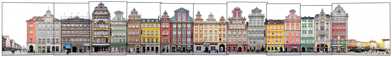
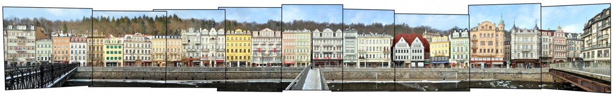
The Stara Louka (german: Alte Wiese which means old meadow) lies at the centre of the Spa Area of the city along the Teplá river. It is regarded its most picturesque street and main esplanade. Here the valley is very narrow and the hills start right behind these buildings with a popular viewpoint pavillon seen above. A little further to the left the Art Nouveau Grandhotel Pupp is situated on this street, the major setting of the James Bond movie „Casino Royale“.

Find more material from Karlovy Vary in our Czech Republic overview.

Click for larger view:

Foto Karlsbad Alte Wiese Tschechien

For classic view and more infos about the street (german link):

Karlovy Vary Stara Louka

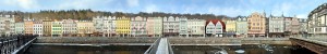
An alternative view of the Stara Louka as a classic panorama:

Karlovy Vary Stara Louka

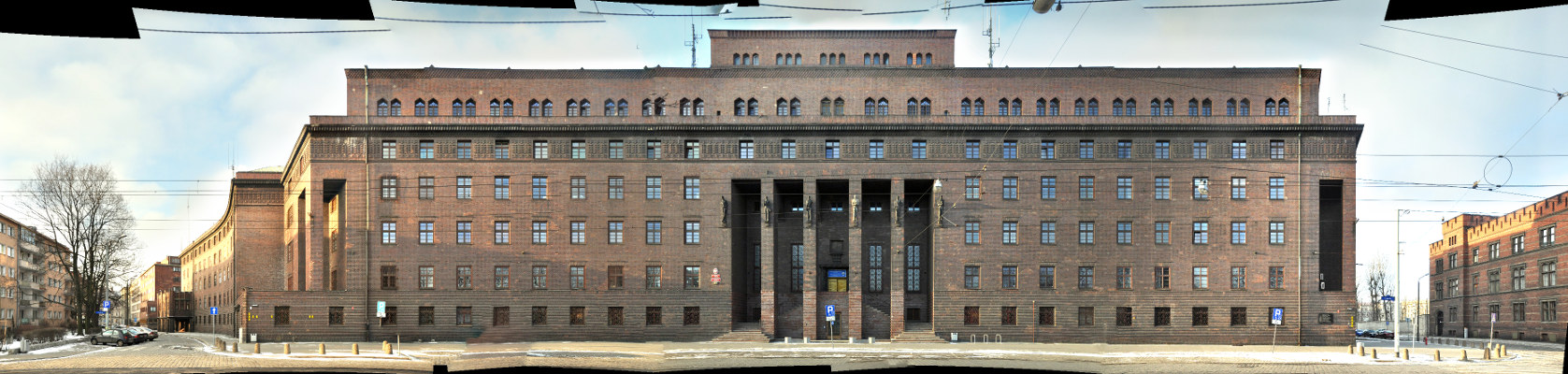
Another street view (work in progress) from Carlsbad:

Kalrsbad Panorama Preview

Munich | Germany | Residenz München | Week 17

Munich [german: München], first mentioned 1158, lies 350 km west of Vienna, 300 km north of Venice and 500 km south of Berlin on the shores of the Isar river. It is the 3rd lagest city in Germany and 19th largest city in Europe.

Population: 1.439.000 [2014] | 1.229.000 [1990] | 729.000 [1930] | 500.000 [1900]

Munich has become the seat of a bavarian duke in 1255 and in 1506 it became capital of all of Bavaria. Munich hosted the 1972 Olympic Games and is home to the Oktoberfest, the world’s largest Volksfest. The city is a financial and cultural centre of Germany and home to Bayern München, one of the most prominent football clubs of europe.

Here we see the complete west side of the Munich Residenz, which had been the Residence of the Bavarian Rulers from 1508 to 1918. The Residenz is the largest city palace of germany. The main facade here was built as the Maximillianische Residenz in the early 17th century and is dominated by two portals flanked by lions and a statue of the mother of god as Patrona Bavariae. On the right end we see the side facade of the Königsbau next to the Max-Joseph-Square.

We have captured a number of Streetlines in the bavarian capital, find a summary of the material we worked on in our Munich overview.

Click for larger view:

Munich Residenz Residence

For classic view and more infos about the square (german link):

Muenchen Residenz

Wroclaw | Poland | Rynek | Week 16

Wroclaw [german: Breslau], first mentioned as Wortizlawa around 900, lies ca. in the middle of the triangle Berlin – Warsaw – Vienna about 250-300 km away from each capital, 4th largest city in Poland, 61st largest city in europe.

Population: 633.000 [2014] | 641.000 [1990] | 625.000 [1933] | 422.000 [1900]

Wroclaw is a european capital of culture in 2016.

Wroclaw has been the capital of the historical region Silesia [german: Schlesien] and is the capital of the Lower Silesian Voivodeship in Poland today. It is the seat of a roman-catholic arch bishop and an evangelic Diocese. In the 15th century it was a member of the Hanseatic League. Together with Silesia Wroclaw has had a very changeful history, belonging successively to Poland, Bohemia, Hungary, Austria, Prussia and Germany until 1945. Then the population was completely replaced and the Germans had to leave the city, while Poles that had to leave areas around Lviv in the east had to move in.

The Rynek [engl: Ring] has historically been called the „Breslauer Ring“ and is the main market square of the city. It is an unusual square in the sense that it has a large middle block of buildings (incl. the town hall) with small alleys going through. Hence there are eight sides of the square, the four larger outsides and four inner sides. Here we see the south side, historically called the „Goldene-Becher-Seite“ [engl: the golden cup side] or „Seite beym alten Galgen“ [engl: side at the old gibbet]. Even if it looks historic, almost all buildings on this side had been destroyed in WWII and later been reconstructed resembling the facades of the early 19th century.

Earlier we have published two more outer sides of the Rynek, the westside and the northside:

Wroclaw Rynek Photography Panorama Image Pic

Wroclaw Breslau Großer Ring Nordseite Rynek

Click for larger view:

Photography Wroclaw Rynek Foto Image Picture Panorama

For classic view and more infos about the square (german link):

Breslau Großer Ring Südseite

We did document several more streets and views from Wroclaw, yet unfinnished, so we can add a few previews here:

Der Tritt oder Mittelblock des Breslauer Ring

one side of the middle block on Rynek

Bezirksgericht in Wroclaw, Podwale

the former prison (built 1844-1887) at the Stadtgraben (now Podwale) which is now a district court

Policji Wroclaw Podwale

the Police Headquarter (built 1927) in Podwale as well

Architektur Breslau Polen

buildings along the street circle around the old town at Kazimierza Wielkiego