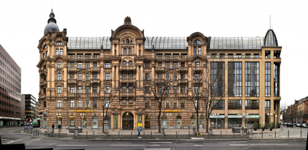
Frankfurt | Germany | Mainufer | Week 28

Frankfurt am Main [italian: Francoforte sul Meno], first mention as Franconofurd in 794, but probably inhabited since the Romans. Frankfurt is situated ca. in the middle of the line Brussels – Prague and about 400 km south of Hamburg. It is the largest city (but not the capital) of the german state Hesse, the 5th largest in Germany and the 48th largest in Europe.

Population: 733.000 [2015] | 645.000 [1990] | 541.000 [1930] | 289.000 [1900]

Frankfurt had been one of the most important cities in the Holy Roman Empire ever since the division of Charlemagne’s Frankish Empire in 843. From 1147 to 1792 most german kings and emperors were crowned in Frankfurt. The city became a free imperial city in 1220 and kept this status till Napoleon. After a brief period of dependance it was a free city again until it was annexed by Prussia in 1866. Frankfurt gained a status as an important trade fair city as early as the 13th century and it established an early currency exchange system in the late 16th century. Today it is the leading financial centre of continental europe, a leading trade fair city and a significant cultural and commercial centre, including central europe’s busiest airport.

This linear panorama view depicts the northern shore of the river Main from the Bankenviertel (banking district) on the left along the central old town of Frankfurt up to the Alte Brücke (old bridge) on the right. Prominent features are the banks skyscrapers on the left, which form the basis for all classic skyline images of Frankfurt, in the centre of the panorama we see the towers around the central square Römerberg and further to the right we see the large Frankfurt Cathedral (german: Kaiserdom St. Bartholomäus). One main feature is missing from this view however, in the middle the river is crossed by the Eiserne Steg bridge, a pedestrian connection to the south bank. See our archive version for more infos, backgrounds and an explanation of the bridge’s dissapearing.

Click for larger view:

Frankfurt Mainkai mit Bankenviertel und Skyline im Panorama

For classic view and more infos about the place (german link):

Frankfurt Mainkai Panorama

We documented more streets and places, which can be seen in our Frankfurt overview.

Some of these examples:

Kaiserstrasse

Kaiserstrasse streetview Frankfurt panorama image foto

Römerberg | City Hall | Nikolaikirche (unfinnished)

Römer Frankfurt Markt Römerberg

Gallusanlage (unfinnished)

Gallusanlage Frankfurt Main Commerzbank

Avignon | France | Palais des Papes | Week 25

Avignon [latin: Avenio], founded in the 6th century BC as Aouenion by greek settlers from Massalia (Marseille). Lies on the left bank of the Rhône river ca. 80 km north of Marseille and 200 km south of Lyon. Avignon is the largest city of the Department Vaucluse, the 5th largest in the Région Provence-Alpes-Côte d’Azur and Nr. 46 in all of France.

Population: 90.000 [2013] | 87.000 [1990] | 57.000 [1931] | 47.000 [1901]

Avignon has always been situated at the border of different countries, it belonged amongst others to the Greek, the Romans, the Franks, the Kingdom of Provence and Arles, the german Holy Roman Empire, the Papal State and finally to France following the French Revolution. Once in history Avignon became an important political centre – that was after the Pope decided to move its seat from Rome to Avignon in 1309, chosen for its proximity to the papal ruled Comtat Venaissin. For about 70 years the city was the centre of Christianity and served seven popes and two antipopes. Afterwards it still served as a second centre of the pope who sent a papal legate to rule the city. Today the cityscape is still dominated by the gothic 14th century Papal Palace and together with the cathedral and the famous Pont St. Bénézet bridge it earned the city UNESCO world heritage status in 1995.

The short papal rule in Avignon shaped the city more than anything else in its 2.500 years of history, especially with the errection of the Palais des Papes (english: Papal Palace). It was built between 1335 and 1370 by the ruling popes, the main architects were Pierre Poisson (old palace) and Jean de Louvres (new palace). Up until today the palace remains the largest gothic style building in europe. In this panoramic view we see the new palace (Palais-neuf) with the main entrance in the right half, the old palace (Palais-vieux) left of it a little bit to the back and the Avignon Cathedral (Cathédrale Notre-Dame des Doms d’Avignon) left of the Papal Palace. The palace gradually lost its importance and after the french revolution it was used as a military barracks and prison which resulted in the damage of most of its interior and frescos. Since 1906 it is a national conservation project and undergoes restoration ever since.

The Avignon Cathedral was originally built in the 12th century and serves as the seat of the archbishop of Avignon. After restoration in the 19th century a gilded statue of the Virgin Mary was placed atop in 1859.

Find more streetviews and cityscapes from France in our France overview.

Click for larger view:

Palais des Papes Architecture Gothic View Street France

For classic view and more infos about the place:

Palais des Papes France Avignon Panorama

Rouen | France | Rue du Gros-Horloge | Week 19

Rouen [latin: Rotomagus], was founded by the tribe of the Veliocasses as Ratumacos, lies about 100 km north-west of Paris and 200 km south of London on the shores of the river Seine. 2nd largest city in the Normandy and 33rd largest city in France.

Population: 111.000 [2013] | 103.000 [1990] | 123.000 [1931] | 116.000 [1901]

The roman Rotomagus was the second most important city of the roman province Gallia after Lugdunum (Lyon). It has been the seat of a bishop since the 4th century. Rouen was captured by the Normans in the 9th century and became the first capital of the Duchy of Normandy in the early 10th century. After the French conquered it again in 1204 it once again belonged to the brittish crown from 1419 to 1449. In late medieval times Rouen was one of the largest european cities with about 40.000 inhabitants. It was here that Joan of Arc was burned at the stake in 1431. Today the city is known for its gothic cathedral and for having the largest number of preserved timber framed buildings in France.

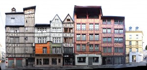
The Rue du Gros-Horloge is a grand example for half-timbered buildings in Rouen. Indeed it is the major street between the cathedral square, we see the Rouen Cathedral at the left edge, and the old marketsquare – the Place de Vieux Marché. The street is named after Rouen’s second landmark, the Gros-Horloge, situated a little further down the right side of the street. It is a fourteenth-century astronomical clock, prominently placed at the side of a tower crossing the street and facing the cathedral.

Find more material from the Normandy in our Normandy overview.

Click for larger view:

Rouen France street view framework version

For classic view and more infos about the street:

Rouen France Panorama half timbered framed

We documented several more streets in Rouen, including more stretches of the Rue du Gros-Horloge, for example (unfinnished):

Image Rouen street view block

And a section following the main panorama further down the right ending at the Gros-Horloge (unfinnished):

Rouen Gros-Horloge Normandie

Here is an unfinnished preview of a little side street, Rue Ecuyere:

Rouen Fachwerk Frankreich

Previously published from Rouen: Rue Ganterie

Rouen street view block image